Geolocate

Ullock topographic map

Click on the map to display elevation.

About this map
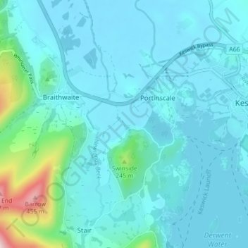
Name: Ullock topographic map, elevation, terrain.

Location: Ullock, Above Derwent, Portinscale, Cumberland, England, CA12 5SP, United Kingdom (54.57760 -3.19274 54.61760 -3.15274)

Average elevation: 120 m

Minimum elevation: 71 m

Maximum elevation: 478 m

Cumberland trails, hiking, mountain biking, running and outdoor activities

Gear up for your next adventure:

🧊Insulated Flasks - Keeps drinks hot or cold during hikes
🧊Personal Water Filters - Drink safely from mountain streams marked on your map
🥾Men's Waterproof Hiking Boots - Durable footwear with deep lugs for muddy and rocky UK terrains
👕Merino Base Layers - Natural temperature regulation for cold weather hiking and camping
📕Outdoor Navigation Books - Learn traditional and modern navigation techniques

As an Amazon Associate, this site earns from qualifying purchases at no extra cost to you.