
Waverly topographic map
Interactive map
Click on the map to display elevation.
About this map
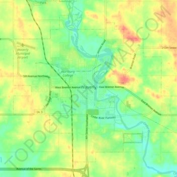
Name: Waverly topographic map, elevation, terrain.
Location: Waverly, Bremer County, Iowa, 50677, United States (42.69653 -92.51483 42.75380 -92.42085)
Average elevation: 293 m
Minimum elevation: 268 m
Maximum elevation: 323 m
Other topographic maps
Click on a map to view its topography, its elevation and its terrain.
Denver
United States > Iowa > Bremer County
Denver, Bremer County, Iowa, 50622, United States
Average elevation: 298 m