
Liupanshan topographic map
Interactive map
Click on the map to display elevation.
About this map
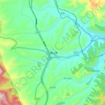
Name: Liupanshan topographic map, elevation, terrain.
Location: Liupanshan, Jingyuan County, Guyuan City, Ningxia, China (35.62349 106.24717 35.70349 106.32717)
Average elevation: 1,993 m
Minimum elevation: 1,782 m
Maximum elevation: 2,595 m