
Strathalbyn topographic map
Click on the map to display elevation.
About this map
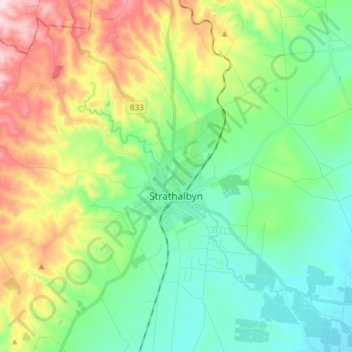
Name: Strathalbyn topographic map, elevation, terrain.
Average elevation: 131 m
Minimum elevation: 25 m
Maximum elevation: 355 m
Other topographic maps
Click on a map to view its topography, its elevation and its terrain.
Mount Compass
Australia > South Australia > Alexandrina Council > Mount Compass
Average elevation: 275 m