
Thank you for supporting this site ❤️
Make a donation
Make a donation
Gear up for your next adventure:
As an Amazon Associate, this site earns from qualifying purchases at no extra cost to you.
Calstock topographic map
Click on the map to display elevation.
Thank you for supporting this site ❤️
Make a donation
Make a donation
Gear up for your next adventure:
As an Amazon Associate, this site earns from qualifying purchases at no extra cost to you.
About this map
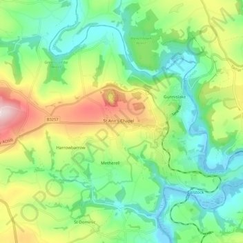
Name: Calstock topographic map, elevation, terrain.
Location: Calstock, St Ann's Chapel, Cornwall, England, United Kingdom (50.48978 -4.28786 50.54394 -4.18024)
Average elevation: 112 m
Minimum elevation: -3 m
Maximum elevation: 329 m
Cornwall trails, hiking, mountain biking, running and outdoor activities
Thank you for supporting this site ❤️
Make a donation
Make a donation
Gear up for your next adventure:
As an Amazon Associate, this site earns from qualifying purchases at no extra cost to you.