

Canoas topographic map
Click on the map to display elevation.
Canoas
Canoas is an industrial and educational hub, drawing residents from surrounding municipalities. It hosts a campus of the Federal Institute of Rio Grande do Sul and several universities including Ulbra, UniRitter, Universidade La Salle, and IPUC. The city is positioned at an elevation of eight meters above sea level, and is distinguished by the Gravataí and Sinos rivers that traverse its landscape.
About this map
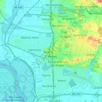
Name: Canoas topographic map, elevation, terrain.
Average elevation: 12 m
Minimum elevation: -1 m
Maximum elevation: 71 m