
Mīrpur Sakro topographic map
Interactive map
Click on the map to display elevation.
Mīrpur Sakro
Mirpur Sakro (Sindhi: ميرپورساڪرو,) is a town located 33 km away from Thatta. while it is 85 km away from Karachi. Mirpur Sakro is at an altitude of 35 meters. It is a small area having a population of around 17,500 settled in a scattered form. The native language spoken here is Sindhi. The most prominent aspects of this village is its connectivity to 88-km-long Gharo-Keti Bunder highway and the Sakro Qabrustan (graveyard) which is around 2 km wide located in the middle of the village. Mirpur Sakro is accessed by both cars and busses.
About this map
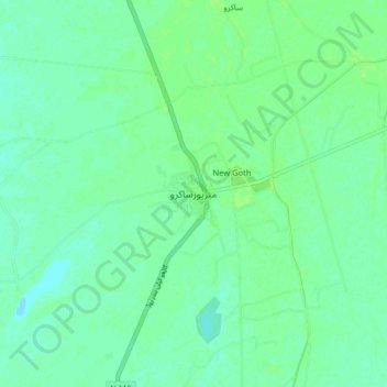
Name: Mīrpur Sakro topographic map, elevation, terrain.
Average elevation: 5 m
Minimum elevation: 0 m
Maximum elevation: 8 m