Geolocate

Olvera topographic map

Click on the map to display elevation.

About this map
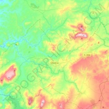
Name: Olvera topographic map, elevation, terrain.

Location: Olvera, Sierra de Cádiz, Cádiz, Andalusia, 11690, Spain (36.87017 -5.41788 37.03736 -5.09569)

Average elevation: 517 m

Minimum elevation: 205 m

Maximum elevation: 1,114 m

Other topographic maps

Click on a map to view its topography, its elevation and its terrain.

Benamahoma

Spain > Andalusia > Sierra de Cádiz > Grazalema

Average elevation: 694 m

Benamahoma

Spain > Andalusia > Sierra de Cádiz > Grazalema

Average elevation: 694 m

Gear up for your next adventure:

🔋Power Banks - Portable chargers for long outdoor trips
🔦Keychain LED Torches - Emergency backup light for finding gear in your pack
🍱Food Containers - Reusable containers for outdoor meals
🧭GPS Trackers - Tracking devices for safety and navigation
🧥Breathable Waterproof Jackets - Essential rain protection for the unpredictable British climate

As an Amazon Associate, this site earns from qualifying purchases at no extra cost to you.