Geolocate

Hernhill topographic map

Click on the map to display elevation.

About this map
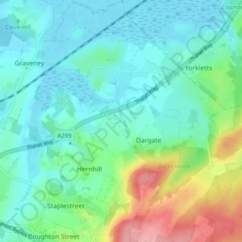
Name: Hernhill topographic map, elevation, terrain.

Location: Hernhill, Dargate, Borough of Swale, Kent, England, United Kingdom (51.29547 0.93325 51.33824 1.00023)

Average elevation: 29 m

Minimum elevation: -1 m

Maximum elevation: 116 m

Kent trails, hiking, mountain biking, running and outdoor activities

Gear up for your next adventure:

🧴Tick Removal Tools - Small, essential health tool for UK woodland and moorland
🛌Sleeping Bags - Warm and packable sleeping bags for outdoor nights
🥾Trekking Poles - Poles to improve stability on uneven terrain
🧦Hiking Socks - Breathable socks designed to prevent blisters on long walks
🧥Waterproof Hiking Jackets - Rain protection for walking in all weather conditions

As an Amazon Associate, this site earns from qualifying purchases at no extra cost to you.