Geolocate

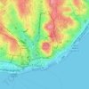
Madalena topographic map

Click on the map to display elevation.

About this map

Name: Madalena topographic map, elevation, terrain.

Location: Madalena, Baixa, Madalena, Lisbon, Portugal (38.70583 -9.13646 38.71273 -9.13185)

Average elevation: 25 m

Minimum elevation: -6 m

Maximum elevation: 98 m

Other topographic maps

Click on a map to view its topography, its elevation and its terrain.
São Jorge Castle

Portugal > Lisbon > Lisbon > Madalena

Average elevation: 34 m

Gear up for your next adventure:

🧰Survival Kits - Emergency tools for remote environments
🕶️Glacier Goggles - Maximum protection for high-altitude snow topography
🗺️Ordnance Survey Maps - Essential paper maps for hiking across the UK national parks
🍳Camping Stoves - Compact stoves for outdoor cooking
⛺Camping Shelters - Emergency and lightweight shelters for outdoor use

As an Amazon Associate, this site earns from qualifying purchases at no extra cost to you.