
Jaitpur topographic map
Interactive map
Click on the map to display elevation.
About this map
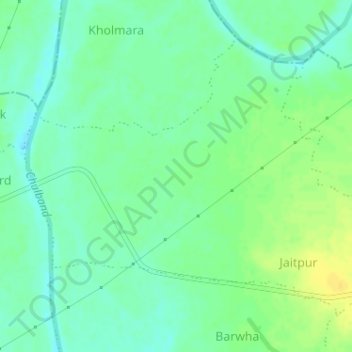
Name: Jaitpur topographic map, elevation, terrain.
Location: Jaitpur, Lakhandur Taluka, Bhandara, Maharashtra, India (20.85413 79.83430 20.87783 79.86635)
Average elevation: 231 m
Minimum elevation: 221 m
Maximum elevation: 244 m
Other topographic maps
Click on a map to view its topography, its elevation and its terrain.
Nanded
India > Maharashtra > Lakhandur Taluka > Nanded
Nanded, Lakhandur Taluka, Bhandara District, Maharashtra, India
Average elevation: 228 m