Geolocate

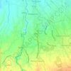
Bacao II topographic map

Click on the map to display elevation.

About this map

Name: Bacao II topographic map, elevation, terrain.

Location: Bacao II, General Trias, Cavite, Calabarzon, 4107, Philippines (14.40217 120.87679 14.41927 120.89500)

Average elevation: 10 m

Minimum elevation: 4 m

Maximum elevation: 17 m

Other topographic maps

Click on a map to view its topography, its elevation and its terrain.

Block 22

Philippines > Cavite > General Trias

Average elevation: 26 m

Tapia

Philippines > Cavite > General Trias > Tapia

Average elevation: 32 m

Malabon River

Philippines > Cavite > General Trias

Average elevation: 16 m

Kaliwa Dam

Philippines > Cavite > General Trias

Average elevation: 22 m

Kaliwa Dam

Philippines > Cavite > General Trias

Average elevation: 22 m

Kaliwa Dam

Philippines > Cavite > General Trias

Average elevation: 22 m

Gear up for your next adventure:

👖Packable Overtrousers - Quick-deploy rain protection for legs in sudden storms
🧊Personal Water Filters - Drink safely from mountain streams marked on your map
🥤Hydration Bladders - Hands-free hydration systems for backpacks
💧Hydration Reservoirs - Convenient water bladders for hands-free drinking on the move
🛌Sleeping Bags - Warm and packable sleeping bags for outdoor nights

As an Amazon Associate, this site earns from qualifying purchases at no extra cost to you.