
Ghuttu topographic map
Interactive map
Click on the map to display elevation.
About this map
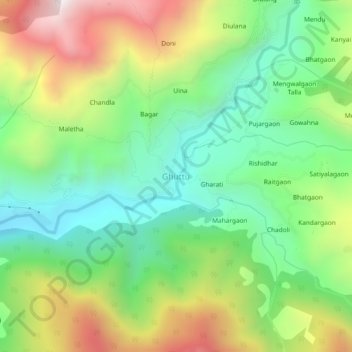
Name: Ghuttu topographic map, elevation, terrain.
Location: Ghuttu, Ghansali, Tehri Garhwal, Uttarakhand, India (30.50890 78.77015 30.54890 78.81015)
Average elevation: 1,856 m
Minimum elevation: 1,437 m
Maximum elevation: 2,542 m
Other topographic maps
Click on a map to view its topography, its elevation and its terrain.
Gangi
India > Uttarakhand > Ghansali
Gangi, Ghansali, Tehri Garhwal, Uttarakhand, India
Average elevation: 2,762 m