Geolocate

Zwickau topographic map

Click on the map to display elevation.

About this map
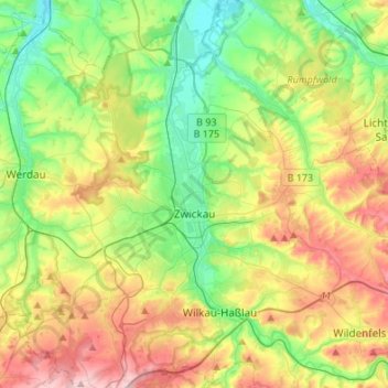
Name: Zwickau topographic map, elevation, terrain.

Location: Zwickau, Langenweißbach, Zwickau, Saxony, 08134, Germany (50.64172 12.40838 50.81284 12.56596)

Average elevation: 329 m

Minimum elevation: 238 m

Maximum elevation: 477 m

Gear up for your next adventure:

💧Hydration Reservoirs - Convenient water bladders for hands-free drinking on the move
❄️Walking Crampons - Added traction for icy slopes and winter peak bagging
👕Merino Base Layers - Natural temperature regulation for cold weather hiking and camping
🧤Hiking Gloves - Warm and durable gloves for cold-weather walks
📕Outdoor Navigation Books - Learn traditional and modern navigation techniques

As an Amazon Associate, this site earns from qualifying purchases at no extra cost to you.