Geolocate

Boudh topographic map

Click on the map to display elevation.

About this map

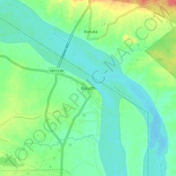
Name: Boudh topographic map, elevation, terrain.

Location: Boudh, Baudh Sadar, Boudh District, Odisha, 762014, India (20.80156 84.28133 20.88156 84.36133)

Average elevation: 93 m

Minimum elevation: 75 m

Maximum elevation: 138 m

Gear up for your next adventure:

🧭Emergency Beacons - Safety beacons for remote outdoor locations
👖Convertible Hiking Trousers - Versatile zip-off pants for changing mountain weather conditions
👟Women's Trail Running Shoes - Agile footwear for fell running and technical trails
🌦️Portable Weather Meters - Handheld tools for monitoring weather conditions
🧢Hiking Hats - Sun and weather protection for outdoor walks

As an Amazon Associate, this site earns from qualifying purchases at no extra cost to you.