Geolocate

Fleet topographic map

Click on the map to display elevation.

About this map
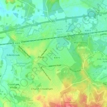
Name: Fleet topographic map, elevation, terrain.

Location: Fleet, Hart, Hampshire, England, United Kingdom (51.26322 -0.87594 51.30238 -0.79030)

Average elevation: 76 m

Minimum elevation: 56 m

Maximum elevation: 118 m

Hampshire trails, hiking, mountain biking, running and outdoor activities

Other topographic maps

Click on a map to view its topography, its elevation and its terrain.

Brookly Stream

United Kingdom > England > Hampshire > Hart > Fleet

Average elevation: 78 m

Gear up for your next adventure:

🧦Hiking Socks - Breathable socks designed to prevent blisters on long walks
🌄Compact Monoculars - Lightweight optics for hiking
⛺Lightweight Tents - Compact tents for backpacking and trekking
🎒Hiking Daypacks (20L) - Compact backpacks for day trips and technical mountain ascents
🥾Hiking Boots - Waterproof and durable boots for long-distance hiking in the UK

As an Amazon Associate, this site earns from qualifying purchases at no extra cost to you.