Geolocate

Pantai Teluk Sisek topographic map

Click on the map to display elevation.

About this map
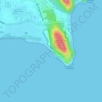
Name: Pantai Teluk Sisek topographic map, elevation, terrain.

Location: Pantai Teluk Sisek, Teluk Cempedak, Kuantan, Pahang, Malaysia (3.80288 103.36481 3.80656 103.36866)

Average elevation: 8 m

Minimum elevation: -1 m

Maximum elevation: 106 m

Gear up for your next adventure:

🛌Sleeping Mats - Insulated mats for comfortable outdoor sleeping
🍳Camping Stoves - Compact stoves for outdoor cooking
🕶️Polarized Sunglasses - Reduces glare from snow and water when reading terrain
📐Altimeters & Barometers - Tools for measuring altitude and air pressure
🕶️Glacier Goggles - Maximum protection for high-altitude snow topography

As an Amazon Associate, this site earns from qualifying purchases at no extra cost to you.