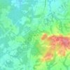
Morganville topographic map
Click on the map to display elevation.
Morganville
According to the U.S. Census Bureau, Morganville has a total area of 5.42 square miles (14.04 km2), including 0.006 square miles (0.016 km2) of water (0.11%). Mount Pleasant, with an elevation of 364 feet (111 m), is in the southeast part of the community. Land in Morganville drains north via Gravelly Brook toward Matawan Creek, and to the west via Deep Run toward the South River. The entire community is within the watershed of Raritan Bay.
About this map

Name: Morganville topographic map, elevation, terrain.
Average elevation: 37 m
Minimum elevation: 15 m
Maximum elevation: 60 m
Other topographic maps
Click on a map to view its topography, its elevation and its terrain.

Herberts Corner
United States > New Jersey > Monmouth County > Marlboro Township
Average elevation: 47 m