
Make a donation
Gear up for your next adventure:
As an Amazon Associate, this site earns from qualifying purchases at no extra cost to you.
Irlam topographic map
Click on the map to display elevation.
Make a donation
Gear up for your next adventure:
As an Amazon Associate, this site earns from qualifying purchases at no extra cost to you.
About this map
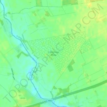
Name: Irlam topographic map, elevation, terrain.
Average elevation: 21 m
Minimum elevation: 11 m
Maximum elevation: 29 m
England trails, hiking, mountain biking, running and outdoor activities
Make a donation
Gear up for your next adventure:
As an Amazon Associate, this site earns from qualifying purchases at no extra cost to you.
Other topographic maps
Click on a map to view its topography, its elevation and its terrain.
Swinton
United Kingdom > England > Salford
Swinton lies at 53°30′44″N 2°20′28″W / 53.51222°N 2.34111°W / 53.51222; -2.34111 (53.5122°, -2.3412°), 167 miles (269 km) northwest of central London, and 4.2 miles (6.8 km) west-northwest of Manchester city centre. Topographically, Swinton occupies an area of gently sloping ground,…
Average elevation: 59 m
Make a donation
Gear up for your next adventure:
As an Amazon Associate, this site earns from qualifying purchases at no extra cost to you.
Pendlebury
United Kingdom > England > Salford
Pendlebury is situated on a ridge overlooking the lower Irwell Valley, almost midway between Manchester and Bolton and is neighboured by Irlams o' th' Height, Pendleton and Clifton. Much of the boundary between Pendlebury and Clifton is defined by Slack Brook which was culverted many years ago after the area…
Average elevation: 64 m
Make a donation
Gear up for your next adventure:
As an Amazon Associate, this site earns from qualifying purchases at no extra cost to you.