
Franklin Park topographic map
Interactive map
Click on the map to display elevation.
About this map
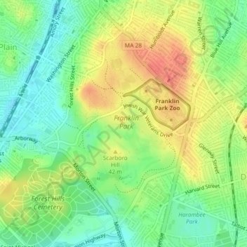
Name: Franklin Park topographic map, elevation, terrain.
Average elevation: 30 m
Minimum elevation: 7 m
Maximum elevation: 56 m
Other topographic maps
Click on a map to view its topography, its elevation and its terrain.
Bunker Hill Monument
United States > Massachusetts > Suffolk County > Boston
Bunker Hill Monument, Monument Square, Charlestown, Boston, Suffolk County, Massachusetts, 02129, United States
Average elevation: 6 m
West Roxbury
United States > Massachusetts > Suffolk County > Boston
West Roxbury, Boston, Suffolk County, Massachusetts, 02132, United States
Average elevation: 42 m
Boston
United States > Massachusetts > Suffolk County > Boston
Boston, Suffolk County, Massachusetts, 02102, United States
Average elevation: 26 m