Geolocate

Salerno topographic map

Click on the map to display elevation.

About this map

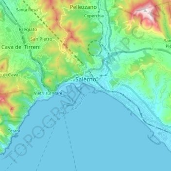
Name: Salerno topographic map, elevation, terrain.

Location: Salerno, Campania, Italy (40.62569 14.73400 40.72699 14.87426)

Average elevation: 161 m

Minimum elevation: -2 m

Maximum elevation: 939 m

Gear up for your next adventure:

🦶Anti-Blister Balms - Protect your feet before long topographic expeditions
🐕Hiking Dog Harnesses - Rugged harnesses for taking your companion on mountain trails
🧥Packable Down Jackets - Lightweight warmth that compresses small in your bag
🧥Waterproof Hiking Jackets - Rain protection for walking in all weather conditions
🛰️Outdoor GPS Navigation - Navigation devices for remote and off-grid areas

As an Amazon Associate, this site earns from qualifying purchases at no extra cost to you.