Geolocate

Sankt Peter-Ording topographic map

Click on the map to display elevation.

About this map
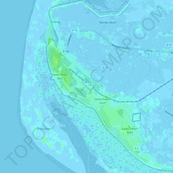
Name: Sankt Peter-Ording topographic map, elevation, terrain.

Location: Sankt Peter-Ording, Eiderstedt, Northern Friesland, Schleswig-Holstein, 25826, Germany (54.27799 8.59944 54.34362 8.70687)

Average elevation: 0 m

Minimum elevation: -14 m

Maximum elevation: 10 m

Other topographic maps

Click on a map to view its topography, its elevation and its terrain.
Gear up for your next adventure:

🛌Sleeping Bags - Warm and packable sleeping bags for outdoor nights
🔥Emergency Fire Starters - Reliable ignition tools for survival situations in damp conditions
🗺️Ordnance Survey Maps - Essential paper maps for hiking across the UK national parks
🥾Walking Shoes - Lightweight walking shoes for countryside and coastal paths
🛑Emergency Bivvy Bags - Heat-reflective survival bags for unexpected nights out

As an Amazon Associate, this site earns from qualifying purchases at no extra cost to you.