Geolocate

Mount Samat topographic map

Click on the map to display elevation.

About this map

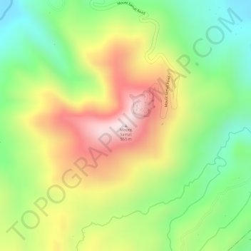
Name: Mount Samat topographic map, elevation, terrain.

Location: Mount Samat, Pilar, Bataan, Central Luzon, 2101, Philippines (14.60407 120.50747 14.60417 120.50757)

Average elevation: 291 m

Minimum elevation: 69 m

Maximum elevation: 533 m

Gear up for your next adventure:

🛌Insulated Sleeping Mats - Crucial thermal protection when sleeping on cold, uneven ground
🥾Men's Waterproof Hiking Boots - Durable footwear with deep lugs for muddy and rocky UK terrains
🦯Walking Poles - Supportive poles for long-distance walking
🚶Walking Pedometers - Simple distance tracking for casual trail walkers
🔦LED Camping Lanterns - Illumination for reading maps inside your tent at night

As an Amazon Associate, this site earns from qualifying purchases at no extra cost to you.