
Thank you for supporting this site ❤️
Make a donation
Make a donation
Gear up for your next adventure:
As an Amazon Associate, this site earns from qualifying purchases at no extra cost to you.
Tacloban topographic map
Click on the map to display elevation.
Thank you for supporting this site ❤️
Make a donation
Make a donation
Gear up for your next adventure:
As an Amazon Associate, this site earns from qualifying purchases at no extra cost to you.
About this map
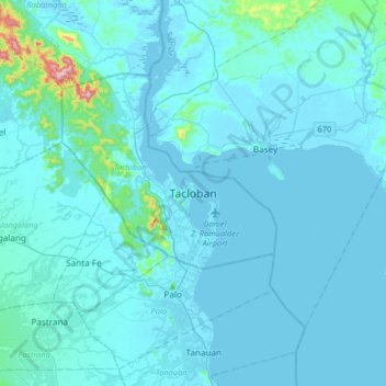
Name: Tacloban topographic map, elevation, terrain.
Location: Tacloban, Leyte, Eastern Visayas, 6500, Philippines (11.08303 124.84814 11.40303 125.16814)
Average elevation: 29 m
Minimum elevation: -1 m
Maximum elevation: 562 m
Thank you for supporting this site ❤️
Make a donation
Make a donation
Gear up for your next adventure:
As an Amazon Associate, this site earns from qualifying purchases at no extra cost to you.