
Thank you for supporting this site ❤️
Make a donation
Make a donation
Gear up for your next adventure:
As an Amazon Associate, this site earns from qualifying purchases at no extra cost to you.
Tequisquiapan topographic map
Click on the map to display elevation.
Thank you for supporting this site ❤️
Make a donation
Make a donation
Gear up for your next adventure:
As an Amazon Associate, this site earns from qualifying purchases at no extra cost to you.
About this map
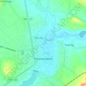
Name: Tequisquiapan topographic map, elevation, terrain.
Location: Tequisquiapan, Querétaro, Mexico (20.50191 -99.91196 20.56704 -99.87393)
Average elevation: 1,907 m
Minimum elevation: 1,866 m
Maximum elevation: 2,098 m
Thank you for supporting this site ❤️
Make a donation
Make a donation
Gear up for your next adventure:
As an Amazon Associate, this site earns from qualifying purchases at no extra cost to you.