Geolocate

Avon topographic map

Click on the map to display elevation.

About this map

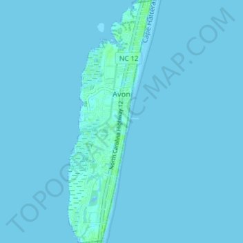
Name: Avon topographic map, elevation, terrain.

Location: Avon, Dare County, North Carolina, 27915, United States (35.32178 -75.51679 35.37142 -75.49570)

Average elevation: 1 m

Minimum elevation: -1 m

Maximum elevation: 7 m

Gear up for your next adventure:

🧣Neck Gaiters - Versatile protection against wind and cold
🗺️Ordnance Survey Maps - Official UK maps for walking and outdoor activities
Insulated Travel Mugs - Keep drinks hot while surveying the landscape from a summit
🔦Keychain LED Torches - Emergency backup light for finding gear in your pack
🔪Outdoor Multi-Tools - Versatile tools for gear repairs and food prep in the wild

As an Amazon Associate, this site earns from qualifying purchases at no extra cost to you.