Geolocate

Westchase topographic map

Click on the map to display elevation.

About this map

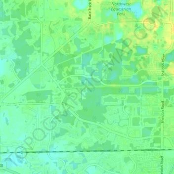
Name: Westchase topographic map, elevation, terrain.

Location: Westchase, Citrus Park, Hillsborough County, Florida, 33626, United States (28.03867 -82.64854 28.08540 -82.57818)

Average elevation: 8 m

Minimum elevation: 0 m

Maximum elevation: 19 m

Other topographic maps

Click on a map to view its topography, its elevation and its terrain.

Gear up for your next adventure:

🛑Emergency Bivvy Bags - Heat-reflective survival bags for unexpected nights out
🦶Anti-Blister Balms - Protect your feet before long topographic expeditions
🧰Survival Kits - Emergency tools for remote environments
🧊Personal Water Filters - Drink safely from mountain streams marked on your map
🧢Thermal Beanie Hats - Prevent heat loss from the head in windy summit conditions

As an Amazon Associate, this site earns from qualifying purchases at no extra cost to you.