Geolocate

Fehmarn topographic map

Click on the map to display elevation.

About this map
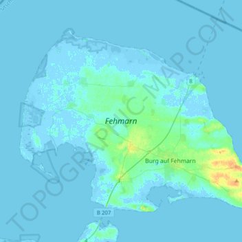
Name: Fehmarn topographic map, elevation, terrain.

Location: Fehmarn, Ostholstein, Schleswig-Holstein, 23769, Germany (54.40137 11.00454 54.53622 11.31286)

Average elevation: 2 m

Minimum elevation: -7 m

Maximum elevation: 26 m

Other topographic maps

Click on a map to view its topography, its elevation and its terrain.

Gear up for your next adventure:

🖼️Topographic Map Art - Decorative 3D-effect posters of famous UK peaks and regions
🎒Backpack Rain Covers - Universal waterproof covers to protect your gear from downpours
📱Phone Mounts for Hiking - Secure mounts to carry your phone on trails
🥾Walking Shoes - Lightweight walking shoes for countryside and coastal paths
🧤Thermal Touchscreen Gloves - Stay warm while operating your GPS or smartphone camera

As an Amazon Associate, this site earns from qualifying purchases at no extra cost to you.