Geolocate

Bootle topographic map

Click on the map to display elevation.

About this map
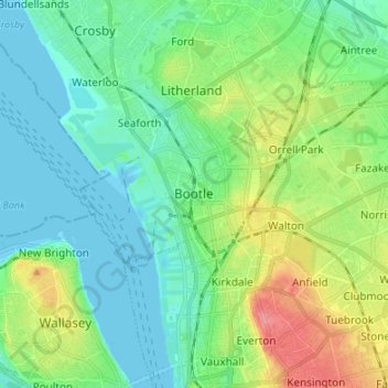
Name: Bootle topographic map, elevation, terrain.

Location: Bootle, Sefton, Liverpool City Region, England, L20 4BL, United Kingdom (53.41069 -3.03488 53.49069 -2.95488)

Average elevation: 22 m

Minimum elevation: -1 m

Maximum elevation: 76 m

England trails, hiking, mountain biking, running and outdoor activities

Other topographic maps

Click on a map to view its topography, its elevation and its terrain.

Hightown

United Kingdom > England > Sefton

Average elevation: 3 m

Formby

United Kingdom > England > Sefton

Average elevation: 5 m

Gear up for your next adventure:

🗺️Scratch-off Peak Maps - Track your progress climbing Munros or Wainwrights
👖Hiking Trousers - Durable trousers designed for rough terrain
🛰️Outdoor GPS Navigation - Navigation devices for remote and off-grid areas
🛰️Handheld GPS Devices - Reliable GPS units for hiking and outdoor navigation
🦟Anti-Midge & Tick Repellent - Vital for hiking in the Scottish Highlands during summer

As an Amazon Associate, this site earns from qualifying purchases at no extra cost to you.