
Pleystein topographic map
Interactive map
Click on the map to display elevation.
About this map
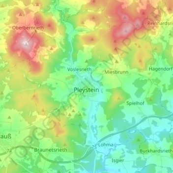
Name: Pleystein topographic map, elevation, terrain.
Average elevation: 587 m
Minimum elevation: 479 m
Maximum elevation: 799 m
Other topographic maps
Click on a map to view its topography, its elevation and its terrain.
Grafenwöhr
Germany > Bavaria > Landkreis Neustadt an der Waldnaab
Grafenwöhr, Landkreis Neustadt an der Waldnaab, Bavaria, 92655, Germany
Average elevation: 450 m
Leuchtenberg
Germany > Bavaria > Landkreis Neustadt an der Waldnaab
Leuchtenberg, Tännesberg (VGem), Landkreis Neustadt an der Waldnaab, Bavaria, 92705, Germany
Average elevation: 504 m
Floß
Germany > Bavaria > Landkreis Neustadt an der Waldnaab > Floß
Floß, Landkreis Neustadt an der Waldnaab, Bavaria, 92685, Germany
Average elevation: 542 m