
Make a donation
Gear up for your next adventure:
As an Amazon Associate, this site earns from qualifying purchases at no extra cost to you.
Baruipur topographic map
Click on the map to display elevation.
Make a donation
Gear up for your next adventure:
As an Amazon Associate, this site earns from qualifying purchases at no extra cost to you.
Baruipur
Baruipur is located at 22°21′38″N 88°25′56″E / 22.3606792°N 88.4322502°E / 22.3606792; 88.4322502. It has an average elevation of 11 metres (36 ft).
Make a donation
Gear up for your next adventure:
As an Amazon Associate, this site earns from qualifying purchases at no extra cost to you.
About this map
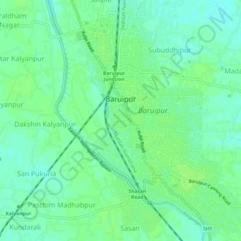
Name: Baruipur topographic map, elevation, terrain.
Location: Baruipur, South 24 Parganas, West Bengal, 700144, India (22.33802 88.42456 22.37639 88.45436)
Average elevation: 7 m
Minimum elevation: 1 m
Maximum elevation: 10 m
Make a donation
Gear up for your next adventure:
As an Amazon Associate, this site earns from qualifying purchases at no extra cost to you.