Geolocate

Mount Perry topographic map

Click on the map to display elevation.

About this map
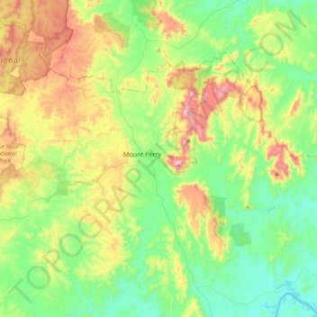
Name: Mount Perry topographic map, elevation, terrain.

Location: Mount Perry, Queensland, 4671, Australia (-25.29821 151.45977 -25.07386 151.82958)

Average elevation: 259 m

Minimum elevation: 50 m

Maximum elevation: 709 m

Gear up for your next adventure:

🕶️Glacier Goggles - Maximum protection for high-altitude snow topography
🔭Compact Hiking Binoculars - Lightweight optics for scouting terrain and spotting wildlife
🥼Base Layers - Thermal base layers for temperature regulation
🧊Personal Water Filters - Drink safely from mountain streams marked on your map
🔦Head Torches - Hands-free lighting for hiking and camping

As an Amazon Associate, this site earns from qualifying purchases at no extra cost to you.