
Hùng Sơn topographic map
Interactive map
Click on the map to display elevation.
About this map
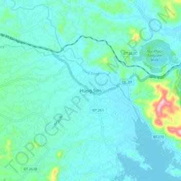
Name: Hùng Sơn topographic map, elevation, terrain.
Location: Hùng Sơn, Đại Từ District, Thái Nguyên Province, Vietnam (21.59320 105.59729 21.67320 105.67729)
Average elevation: 82 m
Minimum elevation: 44 m
Maximum elevation: 308 m
Other topographic maps
Click on a map to view its topography, its elevation and its terrain.