Geolocate

Sampit topographic map

Click on the map to display elevation.

About this map
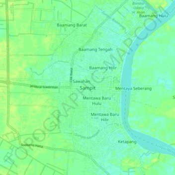
Name: Sampit topographic map, elevation, terrain.

Location: Sampit, East Kotawaringin, Central Kalimantan, Kalimantan, 74322, Indonesia (-2.57891 112.90939 -2.49891 112.98939)

Average elevation: 7 m

Minimum elevation: 1 m

Maximum elevation: 13 m

Gear up for your next adventure:

🧭Professional Hiking Compasses - High-precision liquid-filled compasses for map reading and orientation
👟Men's Trail Running Shoes - Lightweight grip for fast movement over topographic contours
🚶Walking Pedometers - Simple distance tracking for casual trail walkers
🎒Hiking Daypacks (20L) - Compact backpacks for day trips and technical mountain ascents
🧢Thermal Beanie Hats - Prevent heat loss from the head in windy summit conditions

As an Amazon Associate, this site earns from qualifying purchases at no extra cost to you.