Geolocate

Poopara topographic map

Click on the map to display elevation.

About this map
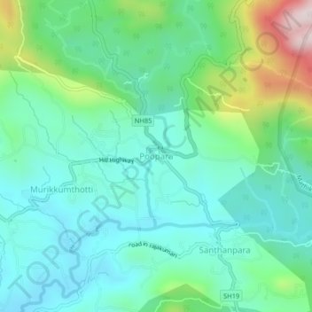
Name: Poopara topographic map, elevation, terrain.

Location: Poopara, Udumbanchola, Idukki District, Kerala, 685619, India (9.95757 77.18730 9.99757 77.22730)

Average elevation: 1,140 m

Minimum elevation: 1,001 m

Maximum elevation: 1,568 m

Other topographic maps

Click on a map to view its topography, its elevation and its terrain.

Santhanpara

India > Kerala > Udumbanchola > Choondal

Average elevation: 1,111 m

Thondimala

India > Kerala > Udumbanchola > Poopara

Average elevation: 1,390 m

Gear up for your next adventure:

🖼️Topographic Map Art - Decorative 3D-effect posters of famous UK peaks and regions
📻Hand-Crank Emergency Radios - Stay updated on weather warnings in remote areas
🧊Insulated Flasks - Keeps drinks hot or cold during hikes
📦Dry Bags - Waterproof bags to protect gear from rain
🔪Outdoor Multi-Tools - Versatile tools for gear repairs and food prep in the wild

As an Amazon Associate, this site earns from qualifying purchases at no extra cost to you.