
Thank you for supporting this site ❤️
Make a donation
Make a donation
Gear up for your next adventure:
As an Amazon Associate, this site earns from qualifying purchases at no extra cost to you.
Bangarapete topographic map
Click on the map to display elevation.
Thank you for supporting this site ❤️
Make a donation
Make a donation
Gear up for your next adventure:
As an Amazon Associate, this site earns from qualifying purchases at no extra cost to you.
About this map
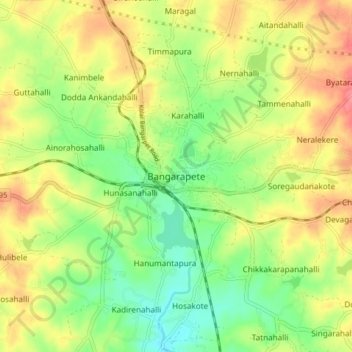
Name: Bangarapete topographic map, elevation, terrain.
Location: Bangarapete, Bangarapet taluk, Kolar, Karnataka, 563114, India (12.94822 78.14126 13.02822 78.22126)
Average elevation: 829 m
Minimum elevation: 793 m
Maximum elevation: 869 m
Thank you for supporting this site ❤️
Make a donation
Make a donation
Gear up for your next adventure:
As an Amazon Associate, this site earns from qualifying purchases at no extra cost to you.