
San Miguel topographic map
Interactive map
Click on the map to display elevation.
About this map
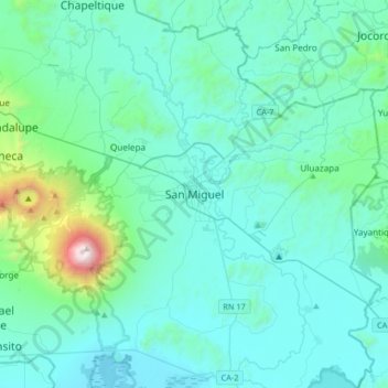
Name: San Miguel topographic map, elevation, terrain.
Location: San Miguel, Departamento de San Miguel, 1217, El Salvador (13.32039 -88.33722 13.64039 -88.01722)
Average elevation: 246 m
Minimum elevation: 17 m
Maximum elevation: 2,099 m
Other topographic maps
Click on a map to view its topography, its elevation and its terrain.
La Estancia
El Salvador > Departamento de San Miguel > Chapeltique
La Estancia, Chapeltique, Departamento de San Miguel, El Salvador
Average elevation: 229 m