
Penderyn topographic map
Interactive map
Click on the map to display elevation.
About this map
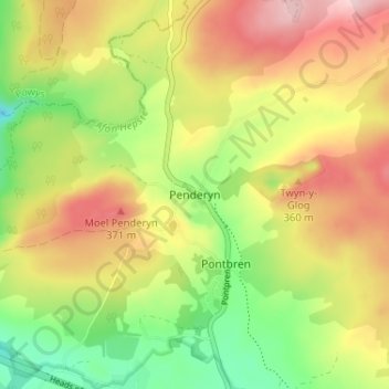
Name: Penderyn topographic map, elevation, terrain.
Location: Penderyn, Rhondda Cynon Taf, Wales, CF44 0TJ, United Kingdom (51.74875 -3.54698 51.78875 -3.50698)
Average elevation: 280 m
Minimum elevation: 157 m
Maximum elevation: 410 m