Geolocate

Westerbork topographic map

Click on the map to display elevation.

About this map

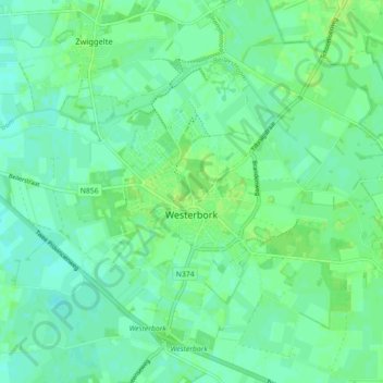
Name: Westerbork topographic map, elevation, terrain.

Location: Westerbork, Midden-Drenthe, Drenthe, Netherlands (52.83384 6.55452 52.87090 6.64336)

Average elevation: 16 m

Minimum elevation: 11 m

Maximum elevation: 22 m

Gear up for your next adventure:

🥾Walking Shoes - Lightweight walking shoes for countryside and coastal paths
🥤Collapsible Water Bottles - Save space in your rucksack as you consume your water
❄️Walking Crampons - Added traction for icy slopes and winter peak bagging
🎒Multi-day Trekking Packs - Large capacity backpacks for wild camping and long-distance trails
🚲Bikepacking Frame Bags - Storage for tools and navigation gear on long off-road rides

As an Amazon Associate, this site earns from qualifying purchases at no extra cost to you.