
Thank you for supporting this site ❤️
Make a donation
Make a donation
Gear up for your next adventure:
As an Amazon Associate, this site earns from qualifying purchases at no extra cost to you.
Petit-Canal topographic map
Click on the map to display elevation.
Thank you for supporting this site ❤️
Make a donation
Make a donation
Gear up for your next adventure:
As an Amazon Associate, this site earns from qualifying purchases at no extra cost to you.
About this map
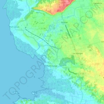
Name: Petit-Canal topographic map, elevation, terrain.
Location: Petit-Canal, Pointe-à-Pitre, Guadeloupe, 97131, France (16.33824 -61.51130 16.44599 -61.39817)
Average elevation: 16 m
Minimum elevation: -2 m
Maximum elevation: 77 m
Thank you for supporting this site ❤️
Make a donation
Make a donation
Gear up for your next adventure:
As an Amazon Associate, this site earns from qualifying purchases at no extra cost to you.