
Bata topographic map
Interactive map
Click on the map to display elevation.
About this map
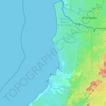
Name: Bata topographic map, elevation, terrain.
Location: Bata, Litoral, Región Continental, Equatorial Guinea (1.66467 9.66163 2.34886 10.02481)
Average elevation: 129 m
Minimum elevation: -2 m
Maximum elevation: 1,077 m