
Thank you for supporting this site ❤️
Make a donation
Make a donation
Gear up for your next adventure:
As an Amazon Associate, this site earns from qualifying purchases at no extra cost to you.
Navalagamella topographic map
Click on the map to display elevation.
Thank you for supporting this site ❤️
Make a donation
Make a donation
Gear up for your next adventure:
As an Amazon Associate, this site earns from qualifying purchases at no extra cost to you.
About this map
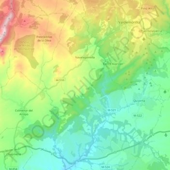
Name: Navalagamella topographic map, elevation, terrain.
Location: Navalagamella, Sierra Oeste, Community of Madrid, 28212, Spain (40.36448 -4.17719 40.52211 -4.07106)
Average elevation: 718 m
Minimum elevation: 496 m
Maximum elevation: 1,218 m
Thank you for supporting this site ❤️
Make a donation
Make a donation
Gear up for your next adventure:
As an Amazon Associate, this site earns from qualifying purchases at no extra cost to you.