
Giro topographic map
Interactive map
Click on the map to display elevation.
About this map
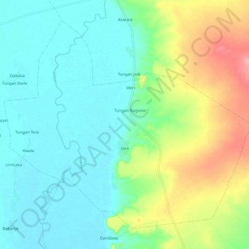
Name: Giro topographic map, elevation, terrain.
Location: Giro, Suru, Kebbi State, Nigeria (11.73142 4.12273 11.82641 4.23906)
Average elevation: 195 m
Minimum elevation: 162 m
Maximum elevation: 274 m