Geolocate

Jerash topographic map

Click on the map to display elevation.

About this map
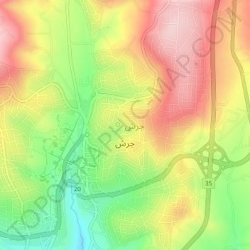
Name: Jerash topographic map, elevation, terrain.

Location: Jerash, Jerash Sub-District, Qasabah Jerash, Jarash, Jordan (32.26831 35.87688 32.29818 35.91256)

Average elevation: 633 m

Minimum elevation: 502 m

Maximum elevation: 752 m

Other topographic maps

Click on a map to view its topography, its elevation and its terrain.

Rashada

Jordan > Jarash > Jerash Sub-District

Average elevation: 494 m

Kafr Khal

Jordan > Jarash > Jerash Sub-District

Average elevation: 969 m

Sakib

Jordan > Jarash > Jerash Sub-District

Average elevation: 639 m

Nebi Hud

Jordan > Jarash > Jerash Sub-District

Average elevation: 565 m

Gear up for your next adventure:

📢Survival Whistles - Essential safety gear for signaling for help in mountain fog
🧢Hiking Hats - Sun and weather protection for outdoor walks
📍Handheld GPS Navigators - Reliable satellite navigation for hiking and off-road exploration
🥤Collapsible Water Bottles - Save space in your rucksack as you consume your water
👟Heavy Duty Boot Laces - Always carry a spare for your hiking footwear

As an Amazon Associate, this site earns from qualifying purchases at no extra cost to you.