
Banga Ⅰ topographic map
Interactive map
Click on the map to display elevation.
About this map
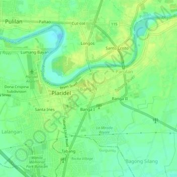
Name: Banga Ⅰ topographic map, elevation, terrain.
Location: Banga Ⅰ, Plaridel, Bulacan, Central Luzon, 3004, Philippines (14.86705 120.84627 14.90705 120.88627)
Average elevation: 10 m
Minimum elevation: 0 m
Maximum elevation: 17 m
Other topographic maps
Click on a map to view its topography, its elevation and its terrain.