Geolocate

Modesto topographic map

Click on the map to display elevation.

About this map
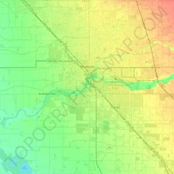
Name: Modesto topographic map, elevation, terrain.

Location: Modesto, Stanislaus County, California, United States (37.52193 -121.09545 37.71183 -120.90282)

Average elevation: 26 m

Minimum elevation: 7 m

Maximum elevation: 49 m

Other topographic maps

Click on a map to view its topography, its elevation and its terrain.
Aurora

United States > California > Stanislaus County > Modesto

Average elevation: 29 m

Eugene

United States > California > Stanislaus County

Average elevation: 62 m

Denair

United States > California > Stanislaus County

Average elevation: 40 m

Gear up for your next adventure:

🦶Anti-Blister Balms - Protect your feet before long topographic expeditions
👟Men's Trail Running Shoes - Lightweight grip for fast movement over topographic contours
🛌Sleeping Bags - Warm and packable sleeping bags for outdoor nights
🧤Thermal Touchscreen Gloves - Stay warm while operating your GPS or smartphone camera
🧥Packable Down Jackets - Lightweight warmth that compresses small in your bag

As an Amazon Associate, this site earns from qualifying purchases at no extra cost to you.