
Shipley topographic map
Click on the map to display elevation.
About this map
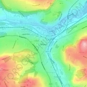
Name: Shipley topographic map, elevation, terrain.
Average elevation: 121 m
Minimum elevation: 62 m
Maximum elevation: 225 m
England trails, hiking, mountain biking, running and outdoor activities
Other topographic maps
Click on a map to view its topography, its elevation and its terrain.
Cackleshaw
United Kingdom > England > Bradford > Keighley > Oakworth > Cackleshaw
Average elevation: 219 m