Geolocate

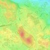
Linköping topographic map

Click on the map to display elevation.

About this map
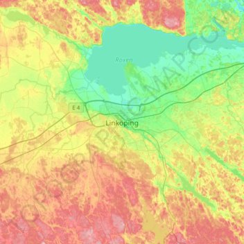
Name: Linköping topographic map, elevation, terrain.

Location: Linköping, Linköpings kommun, Östergötland County, 582 19, Sweden (58.24981 15.46453 58.56981 15.78453)

Average elevation: 76 m

Minimum elevation: 28 m

Maximum elevation: 149 m

Other topographic maps

Click on a map to view its topography, its elevation and its terrain.
Knabben

Sweden > Östergötland County > Norrköping

Average elevation: 45 m

Vadstena

Sweden > Östergötland County

Average elevation: 98 m

Mjölby kommun

Sweden > Östergötland County

Average elevation: 123 m

Navestad

Sweden > Östergötland County > Norrköping

Average elevation: 34 m

Nässja

Sweden > Östergötland County

Average elevation: 91 m

Illern

Sweden > Östergötland County > Linköping

Average elevation: 72 m

Kinda kommun

Sweden > Östergötland County

Average elevation: 133 m

Halgen

Sweden > Östergötland County

Average elevation: 88 m

Gear up for your next adventure:

🦶Anti-Blister Balms - Protect your feet before long topographic expeditions
🧵Survival Paracord - Multi-purpose cordage for emergency repairs and shelters
🧥Softshell Jackets - Breathable jackets for active outdoor use
🥾Hiking Boots - Waterproof and durable boots for long-distance hiking in the UK
🧣Fleece Neck Warmers - Extra insulation for winter topographic surveys

As an Amazon Associate, this site earns from qualifying purchases at no extra cost to you.