
Rohrbach-Berg topographic map
Interactive map
Click on the map to display elevation.
About this map
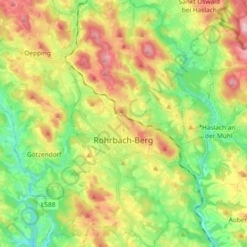
Name: Rohrbach-Berg topographic map, elevation, terrain.
Location: Rohrbach-Berg, Bezirk Rohrbach, Upper Austria, 4150, Austria (48.53480 13.95609 48.62113 14.03655)
Average elevation: 582 m
Minimum elevation: 453 m
Maximum elevation: 750 m