Geolocate

Redwood Junction topographic map

Click on the map to display elevation.

About this map
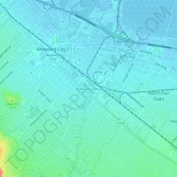
Name: Redwood Junction topographic map, elevation, terrain.

Location: Redwood Junction, Redwood City, San Mateo County, California, 94063, United States (37.45734 -122.24176 37.49734 -122.20176)

Average elevation: 9 m

Minimum elevation: -2 m

Maximum elevation: 60 m

Other topographic maps

Click on a map to view its topography, its elevation and its terrain.
Gear up for your next adventure:

🛑Emergency Bivvy Bags - Heat-reflective survival bags for unexpected nights out
🛰️Outdoor GPS Navigation - Navigation devices for remote and off-grid areas
🥾Women's Waterproof Hiking Boots - High-performance trekking boots designed for all-weather comfort
🌂Windproof Trekking Umbrellas - Surprising but effective rain protection on low-wind trails
🎒Backpack Rain Covers - Universal waterproof covers to protect your gear from downpours

As an Amazon Associate, this site earns from qualifying purchases at no extra cost to you.